Class 8 Social Science Part 2 Chapter 7 – India’s Urban Landscape from the new NCERT textbook Exploring Society: India and Beyond. Get easy Notes and complete Book Solutions with important concepts, questions and answers, and revision material for effective learning, practice and exam preparation.
India’s Urban Landscape
Chapter 7
🌆 Easy Notes • Concepts • Examples • Book Solutions
Exploring Society: India and Beyond | Grade 8 Part 2
— Jane Jacobs, American Urbanist
🌟 The Big Questions
📖 Chapter Introduction
India has a rich urban history. Ancient cities such as Dholavira, Kalibangan and Rakhigarhi show that organised urban settlements existed in India thousands of years ago. Historical cities such as Vijayanagara, Varanasi and Ujjain continue to flourish.
Today, cities are places where large numbers of people live and where many types of businesses, occupations, government institutions, transport systems and communication networks are concentrated.
Urban areas usually have elected local bodies responsible for infrastructure and public amenities.
Rural areas mainly consist of villages. They generally have smaller populations, closer communities and a larger dependence on agriculture. They are governed by Gram Panchayats.

🏡 Urban and Rural Areas
| Urban Areas | Rural Areas |
|---|---|
| Large and concentrated population | Usually smaller population |
| Many businesses and occupations | More agriculture-based occupations |
| Well-developed transport and communication | Generally less elaborate transport systems |
| Municipal/local urban bodies | Gram Panchayats |
| Many industries and services | More dependence on agriculture and allied activities |
👥 Population Density in Cities
Population density tells us how many people live in a particular area. It helps us understand whether a place is densely or sparsely populated.
It is usually expressed as people per square kilometre.
High Density
Many people live in a small area. Large cities often have high population density.
Low Density
Fewer people live over a larger area. Rural areas may have lower population density.
Satellite View
A satellite view is a top-down view of Earth’s surface captured by satellites.
💼 How Do Cities Become Centres of Economic Activities?
Cities often grow because of favourable geographical and economic conditions.
🌊 Rivers and Coasts
Rivers and coastal locations make transportation and trade easier.
🛣️ Trade Routes
Places located along important trade routes can become markets and commercial centres.
🌾 Raw Materials
Easy access to agricultural products and raw materials encourages industries.
🏭 Industries
Factories create jobs and attract workers, leading to urban growth.
🎓 Education
Universities and educational institutions attract students, teachers and skilled workers.
💻 Technology
IT companies, start-ups and technology-based businesses create new economic opportunities.
🏙️ Important Examples of Indian Cities
🏭 Jamshedpur
Sakchi was a small village. Its location near rich iron ore deposits helped Tata establish a steel plant. It gradually developed into Jamshedpur.
⚓ Mumbai
Its coastal location and port helped trade and commerce grow. Mumbai also became an important financial and cultural centre.
💻 Bengaluru
Bengaluru developed as an IT hub because of software companies, start-ups, skilled workers and higher education institutions.
💻 Hyderabad
Hyderabad has developed as an important centre for technology-based businesses.
🎨 Jaipur
Jaipur is famous for handicrafts, gem jewellery, tourism and its historic planned city.
🛍️ Moradabad
Moradabad is well known for its brass work.
🧵 Ludhiana & Tirupur
Both are important centres of textile production.
🪵 Channapatna
Channapatna is famous for traditional wooden toys.
🥻 Kanchipuram
Kanchipuram is famous for silk sarees.
🌆 What Leads to Urbanisation?
Urbanisation means the shift of population from rural areas to urban areas and the corresponding decrease in the proportion of people living in rural areas.
Farm-related work
Trading Centre
Services
More Jobs
Why do people move towards cities?
- Better employment opportunities
- Education
- Healthcare
- Industries and businesses
- Transport facilities
- Better services and amenities
🌊 Mumbai – A Major Economic Hub
Mumbai’s location along the Arabian Sea helped it become an important port city.
The establishment of the Bombay Stock Exchange (BSE) in 1875 strengthened its financial importance.
Mumbai also developed a large film industry, modern infrastructure, transport systems, offices and commercial centres.
💻 Bengaluru – The Silicon Valley of India
Bengaluru became an important IT hub because of the concentration of software companies, start-ups and higher education institutions.
Industries and educational institutions work together to encourage innovation and create skilled employment.
Advanced technologies such as Artificial Intelligence are also used in modern businesses.
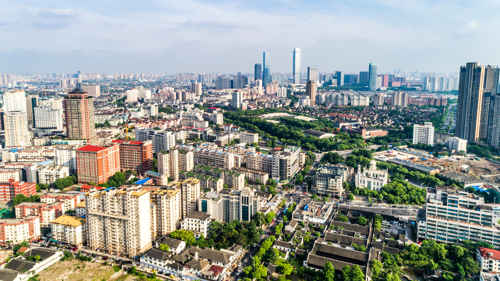
🕌 Tourism and Cultural Economy
Some cities grow because of their historical, cultural and religious importance.
Agra
The Taj Mahal attracts large numbers of visitors and supports tourism-related activities.
Varanasi
Pilgrims and tourists support transport, food, handicrafts and local businesses.
Amritsar
Religious tourism supports many local economic activities.
Delhi
Delhi has long been a centre of administration, culture, education and trade.
🏛️ Delhi – Administration, Culture and Business
Delhi has been an important centre of culture, trade and administration for centuries.
After Independence, New Delhi became the capital of the Indian Republic. Ministries, universities, research institutions and businesses attracted people from different parts of India.
The growth of Delhi increased pressure on housing, water, sewerage and transport.
The development of the National Capital Region (NCR), including places such as NOIDA and Ghaziabad, helped distribute some of the population and economic activities.
🎭 Cities as Cultural Hubs
Cities bring people from different regions together. As a result, different languages, foods, festivals, customs and traditions are shared.
🌮 Food
Mumbai’s famous vada pav became popular among workers and later became a widely known city snack.
🎉 Festivals
Kolkata is famous for Durga Puja, which was inscribed on UNESCO’s Intangible Cultural Heritage list in 2021.
🏛️ Museums
Cities provide museums and cultural institutions where people learn about history and culture.
🏟️ Stadiums
Sports facilities create opportunities for recreation and social interaction.
Cultural centres, libraries, museums, stadiums and public spaces allow people to meet, learn and build relationships.
⚠️ Challenges Faced by Cities
Rapid urban growth puts pressure on resources and infrastructure. Some common challenges are:
🌫️ Air Pollution
Vehicles, industries and other sources can reduce air quality.
🚗 Traffic Jams
More vehicles and limited road capacity can create congestion.
💧 Water Scarcity
Growing populations increase demand for water.
🗑️ Waste
Large populations generate large amounts of solid waste.
🏚️ Slums
Lack of affordable housing can lead to overcrowded settlements with limited services.
🌳 Loss of Green Spaces
Rapid construction may reduce parks, forests and open spaces.
🌧️ Urban Flooding
Poor drainage, construction over natural water channels and heavy rainfall can increase flooding.
🌡️ Heat Islands
Large built-up areas can become hotter than surrounding areas.
🌫️ Air Quality Index – AQI
The Air Quality Index (AQI) is a numerical scale used to communicate the quality of air.
It considers pollutants such as:
- PM2.5
- PM10
- Carbon monoxide
- Sulfur dioxide
🏚️ Urban Slums
Slums are overcrowded urban settlements where housing and municipal services may be inadequate.
They may develop near railway tracks, industrial areas or city peripheries where affordable land is available.
Many slum residents contribute to city life through informal work such as:
- Vegetable vending
- Domestic work
- Laundry services
- Construction work
- Plumbing
Improving housing, health, education, sanitation and basic services is an important urban challenge.
💧 Bengaluru – Water and Lake Management
Bengaluru has experienced water shortages as well as flooding. Rapid urbanisation, groundwater overuse, poor rainwater harvesting and encroachment of lake beds have contributed to the problem.
Community groups, non-profit organisations and Resident Welfare Associations have participated in lake revival through activities such as:
- Desilting
- Repairing bunds
- Clearing drainage channels
- Planting native species
- Restocking fish
🏗️ Planning Our Cities
Cities are dynamic systems. Their needs change as population, technology, climate and economic activities change.
Urban planners need to think about:
🌸 India’s ‘Pink City’ – Jaipur
Jaipur was planned by Vidyadhar Bhattacharya under Maharaja Sawai Jai Singh II in 1727.
The city was planned using a grid pattern with rectangular blocks called chowkris.
- Wide streets
- Open spaces
- Gardens
- Nine public squares
- Markets
- Temples and important buildings
- City wall and gates
- Water reservoirs and canals
Buildings along important streets were made using pink sandstone, giving Jaipur its distinctive appearance and its name, the Pink City.

🌏 Dynamic Urban Planning of Singapore
Singapore is a densely populated island nation that has invested heavily in long-term urban planning.
📅 Concept Plan
Looks decades ahead and guides long-term land use.
🗺️ Master Plan
Updated periodically according to changing needs.
🚇 Public Transport
Railways, buses, walking paths and cycling routes are integrated.
🌱 Green Buildings
Vertical and rooftop gardens help increase greenery.
🏠 Mixed-use Areas
Homes, offices, parks and recreational facilities are located near one another.
♿ Inclusive Planning
Facilities are designed to serve different age groups and community needs.
🇮🇳 Urban Redevelopment in India
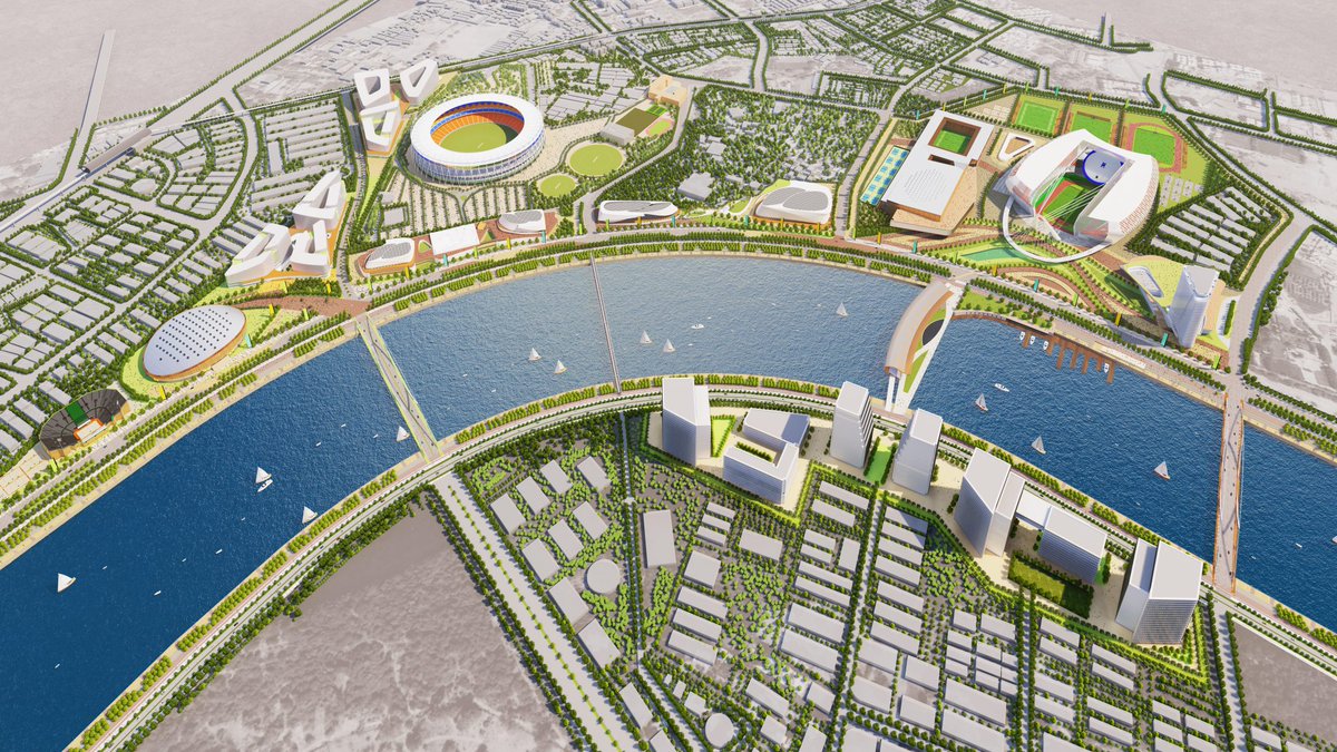
Sabarmati Riverfront – Ahmedabad
The Sabarmati Riverfront combines public utility, ecology and recreation.
It includes promenades, parks, markets, boating areas and the Atal Bridge for pedestrians and cyclists.
Gangtok – M.G. Road
Mahatma Gandhi Road in Gangtok is a pedestrian-only shopping and commercial area with shops, restaurants and hotels.
📚 Important Terms
Urbanisation
Shift of population from rural to urban areas.
Population Density
Number of people living per unit area.
Demographer
A person who studies population characteristics.
Urban Planner
A person who plans land use and infrastructure in towns and cities.
BPO
Business Process Outsourcing means hiring another service provider to perform specific business functions.
Master Plan
A long-term plan guiding future growth and development of a city.
Vertical Garden
Plants grown on walls or vertical structures instead of only on the ground.
Blue Zone
A place associated with unusually long and healthy lives.
⚡ Chapter in Short
- Cities are centres of economic and cultural activities.
- Location, trade, industries, education and infrastructure help cities grow.
- Urbanisation means a shift of population towards urban areas.
- Cities provide jobs, services, education and cultural opportunities.
- Rapid urbanisation can create traffic, pollution, waste and housing problems.
- Water scarcity and flooding can result from poor urban planning.
- Urban slums often lack adequate housing and municipal services.
- Urban planning helps manage land, transport, housing and public facilities.
- Jaipur is an example of historical planned urban development.
- Singapore demonstrates dynamic and sustainable urban planning.
- Modern cities need to balance economic growth with environmental sustainability.
📘 Questions and Activities – Book Solutions
1. What are some common features of cities?
2. Can you think of a city or town near you that has grown in population? What could be the underlying reasons for the urban migration?
3. With reference to the epigraph at the beginning of the chapter, who are the participants in the making of the city and what could be their contribution?
4. In what ways can urbanisation affect rural areas? Do cities also depend on rural areas? If yes, how? In what ways can rural and urban areas help each other develop?
5. What is urban planning? What are the risks of ignoring sustainable urban planning as cities expand into villages and forest areas?
6. Observe your own neighbourhood. What signs of good or poor planning do you notice? How do they affect daily life for you and others?
7. Imagine you are an urban planner, what are the things you would consider to plan a city? Do groups like children,
Continued question:
the elderly, and people with disabilities get easy access to parks, toilets, and public transport? What changes would you introduce to make it more inclusive?
8. Suppose your town, village or city has 100 people. Draw a rough map of the place on a graph paper. Imagine each square on the paper represents a specific area of the place, like residential neighbourhoods, parks, schools, factories, post offices and so on.
Now, distribute the 100 people throughout the area. You can decide where the people will live, whether they all live in the residential areas, or some live in the commercial or industrial areas. Write this number in each of the boxes.
In your depiction of the map, which areas are heavily populated and which are not? What were the reasons behind your choices of allocation of people?
9. Observe the satellite view of Mumbai and Gangtok, respectively. Find out their population density and likely reasons for the difference.
10. Find out how the city of Beijing, China, tackled the problem of air pollution. Prepare a report outlining measures that can be taken in India to mitigate air pollution in cities.
11. Talk to a family or community member who has moved from a village to a city. Ask them the reason for the same and their experience, challenges and opportunities. How does city life compare to rural life?
12. Learn about urban planning in other cities around the world. In what ways can some of those aspects be adapted for a city near you?
13. Explore and suggest action points with respect to urban planning in cities to mitigate the challenges below and write a report. Two have been completed for you.
Conduct awareness drives for segregation of wet and dry waste, composting and responsible disposal.
Traffic congestion:
Promote public transport, carpooling, cycling and walking. Improve road and traffic management.
Inadequate safety of residents:
Improve street lighting, CCTV where appropriate, emergency services, pedestrian crossings and police facilities.
Poor mobility within the city:
Improve buses, metro systems, footpaths, cycling paths and accessible transport.
Expansion of slums:
Provide affordable housing, sanitation, clean water, healthcare and education.
Heat waves during summers:
Increase trees and green spaces, create shaded public areas, use heat-resistant materials and develop cool public spaces.
14. Find out about a slum rehabilitation program where people moved from slums to proper housing in your city. What do you think its possible benefits could be for the communities there?
🔎 Let’s Explore – Chapter Activities
Activity 1: Urban or Rural?
Observe your locality and write whether it is a village, town or city. Look for roads, houses, occupations, shops, farms, transport, schools and public services.
Activity 2: City Change Survey
Talk to adults from different generations and ask how their locality has changed over the years.
- Has the population increased?
- Have farms or open spaces changed into buildings?
- Has traffic increased?
- Have new jobs appeared?
- What do older people miss?
- What improvements do they appreciate?
Activity 3: Local Culture Hunt
Find a nearby town or city and list:
- Traditional food
- Festivals
- Handicrafts
- Local clothing
- Historical places
- Special occupations
📊 Quick Comparison
| Feature | Rural Area | Urban Area |
|---|---|---|
| Population | Usually smaller | Usually larger and concentrated |
| Main occupations | Agriculture and allied activities | Industry, trade and services |
| Transport | Generally less elaborate | Usually more developed |
| Businesses | Fewer | Many and diverse |
| Services | Generally fewer specialised services | Many specialised services |
🎯 Exam Revision Points
🧠 Remember in One Minute
Prepare more, practise more and learn better! This NCERT Class 8 Social Science Part 2 worksheet for Chapter 7 includes important questions and revision exercises to help students understand key concepts, improve their practice and strengthen their preparation for class tests and examinations.
Class 8 Social Science Part 2 Chapter 7, Class 8 Social Science Chapter 7 Notes, India’s Urban Landscape, Class 8 Social Science Part 2 Chapter 7 Notes and Book Solutions, India’s Urban Landscape Notes, India’s Urban Landscape Book Solutions, Class 8 Social Science Questions and Answers, Class 8 Social Science Part 2 Solutions, NCERT Class 8 Social Science, NCERT Class 8 Social Science Part 2, CBSE Class 8 Social Science, Class 8 Social Science Study Material, Class 8 Social Science Revision Notes, Class 8 Social Science Worksheets